There is a series of vertical lines we call Eastings and horizontal lines we call Northings, these lines make up the grid.
There more digits in a grid reference, the more precise the location. For example, a six figure grid reference gives a more accurate location than a four figure grid reference.
Eastings runs vertically or north to south and shows how far East you have travelled. Northings run horizontally or west to east and shows how far North you have travelled.
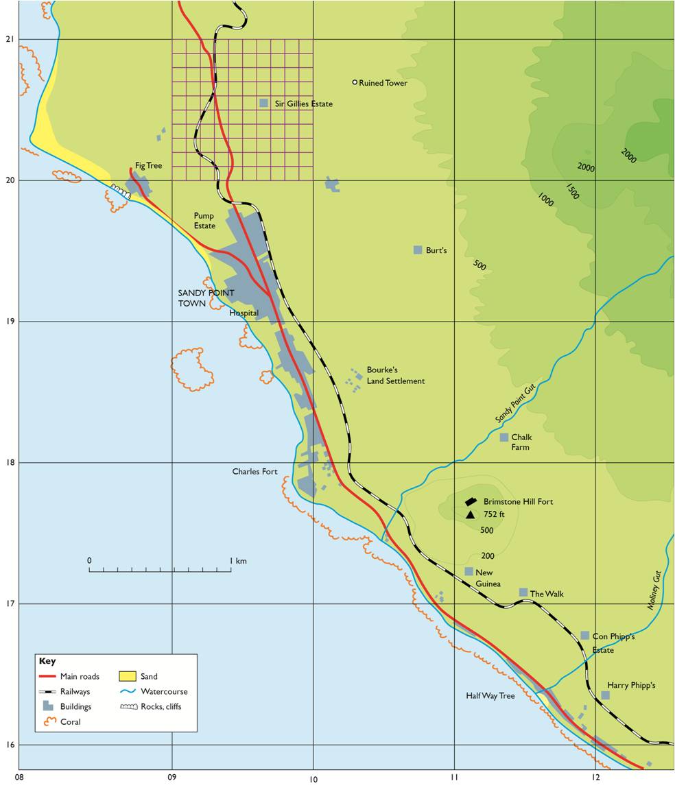
The two numbers on the vertical and horizontal lines add up to make four-figure grid reference. For example on figure 1. Burt is found in grid 1029. Similarly, Brimstone Hill Fort is found in grid 1117. Remember, Eastings are always given first.
If we want to give an exact location we divide the grid into tenths (see 0920 on figure 1). When we do this we are finding to six-figure grid reference which gives the exact location of features on a map. For example, Sir Gillies Estate has a six-figure grid reference of 096205. Also the ruined tower is located in grid 103207.
There are some important points to remember about grid references:
§ Eastings are vertical lines that run from north to south, their numbers increase in values from west to east. They tell how far east to go. They are stated first.
§ Northings are horizontal lines that run from east to west, their numbers increase in values towards the north. They tell how far north to go. They are stated second.
§ When stating a grid reference, the easting is always
given first.
given first.
§ The distance between one grid line and next may be divided into ten imaginary parts for stating locations precisely. This is called six figure grid reference.
§ REMEMBER: Down the hall, up the steps!
No comments:
Post a Comment